Roman City Planning: How Romans Organized Urban Space

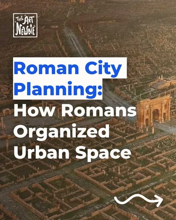
Timgad is so useful for Roman city planning because the urban grid is still visible at a glance.
Roman city planning is where Roman architecture becomes a full urban system. It is not only about individual monuments like temples, baths, or amphitheatres. It is about how streets, infrastructure, housing, public buildings, and power were arranged so that a city could function as a coherent whole.
That is what makes the topic so interesting. Roman urban planning was not simply a matter of drawing tidy grids. It was about making movement legible, giving civic life a center, and tying water, roads, drainage, and public space into one organized environment. In some cities that order looks very regular. In others, especially in Rome itself, it is more layered and irregular. But the underlying goal is often the same: to turn urban space into something readable, connected, and governable.
This is also why Roman city planning matters far beyond antiquity. It shows a civilization thinking at the scale of the street, the block, the district, and the entire city at once.
Quick answer
Roman city planning organized streets, forums, infrastructure, and housing into a practical urban order. In many planned towns, major axes, a central forum, and strong public infrastructure helped structure civic life and imperial control.
What is Roman city planning?
Roman city planning is the way Romans laid out, organized, and connected urban space. That includes streets, public squares, infrastructure, housing, water supply, drainage, and the placement of important civic buildings.
This definition matters because planning is not only about geometric layout. A city may look orderly on a map and still function badly. Roman planning was not just formal. It was practical. Streets had to connect. Water had to arrive. Waste had to leave. Public life needed spaces in which to gather, trade, judge, worship, and govern.
That is why Roman city planning belongs within the larger world of Roman architecture. Roman builders were not only designing isolated buildings. They were shaping urban systems. A basilica means something different when placed beside a forum. A road means something different when it leads toward a gate or a civic center. An aqueduct matters differently once it feeds baths, fountains, and homes.
So Roman planning is best understood as spatial organization with civic purpose.
Was every Roman city a grid?
No, and this is one of the most useful corrections to make early on.
People often imagine Roman cities as perfectly rectangular grids, with every street crossing neatly at right angles. That image is partly true, especially for many colonies and newly planned settlements. But it is not true everywhere. Roman city planning was often regular, yet not always rigid. Terrain, earlier settlements, local history, and later growth could all change the urban form.
This distinction matters because the Romans were practical planners rather than abstract perfectionists. If a gridded plan worked, they used it. If the land, an older town, or a strategic condition demanded adaptation, they adjusted.
Rome itself is the clearest example. The capital of the empire was not a textbook grid. It grew over centuries and became dense, layered, and topographically complex. Yet even there, Roman urban thinking still appears in the organization of roads, forums, infrastructures, monuments, and districts.
So the right way to think about Roman urban planning is not “all Roman cities were grids.” It is closer to this: many Roman towns were planned with strong regularity, but Roman planning was flexible enough to work beyond the grid too.
What were cardo and decumanus?
In many planned Roman towns, the urban layout was structured around two principal axes. These are often called the cardo maximus and decumanus maximus.
The cardo usually refers to the main north-south street. The decumanus usually refers to the main east-west street. In many Roman colonies and organized towns, these major routes gave the city a clear orientation and helped define the street network around them.
This is one reason Roman planning can feel so legible. The city does not just spread outward without hierarchy. It often has strong main lines that give structure to movement and to the arrangement of blocks.
At the same time, it is worth staying a little cautious. Not every Roman city fits the model neatly, and modern writers sometimes apply these terms more broadly than the ancient evidence always guarantees. Still, as a practical way to understand Roman city layout, they remain very useful.
The larger point is that Roman planning often depended on clear main routes. Those routes shaped circulation, commerce, and the relation between the city’s entrance points and its civic center.
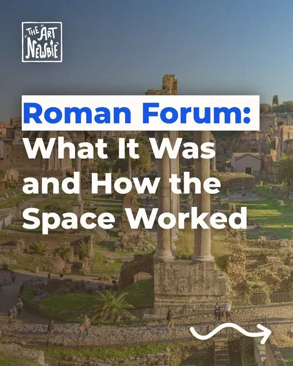
Why was the forum so important?
If Roman streets gave the city structure, the forum gave it a civic heart.
The forum was the city’s principal public space: a centrally placed open area usually surrounded by important buildings and colonnades. It was where politics, law, business, ceremony, and public encounter came together. In many Roman towns, the forum stood near the intersection of the main streets, which made it both accessible and symbolically central.
This is why the Roman forum matters so much in understanding Roman urbanism. It was not just a plaza. It was the place where the city represented itself to itself.
Around the forum you might find temples, administrative buildings, shops, and especially the Roman basilica. The basilica was a large covered hall used for law, commerce, and civic transactions. Its placement near the forum shows how Roman city planning linked open public space to enclosed civic architecture.
This combination of square and surrounding institutions is one of the clearest signs of Roman order. The city is not only traversed by streets. It is also anchored by a center where power, exchange, and public life become visible.
How did infrastructure shape the city?
Roman city planning makes the most sense when you stop thinking only about monuments and start thinking about infrastructure.
A city needs movement, water, and drainage. That is why Roman roads, Roman aqueducts, and sewer systems are so important to the urban story. They are not secondary technical details. They are part of what makes the city possible.
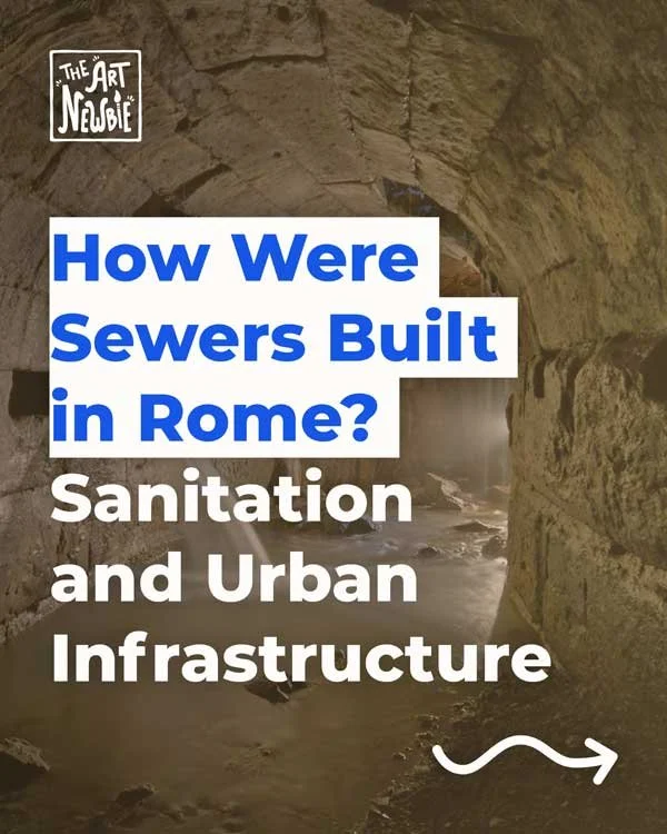
Roads connected the city to territory beyond it and organized circulation inside it. Aqueducts brought fresh water for baths, fountains, households, and workshops. Sewers and drainage helped remove waste and manage runoff, especially in dense areas. If you want to follow that hidden side of the city more directly, how were sewers built in Rome is an essential next step.
This is also where Roman planning becomes especially close to ancient Roman engineering. Urban order was not only visual. It was hydraulic, circulatory, and technical. Roman cities worked because their visible spaces and hidden systems were tied together.
That practical intelligence is one reason Roman urbanism still feels so influential. It treats the city not as a picture, but as a functioning mechanism.
Where did people actually live?
A Roman city was not made only of forums and temples. It was also made of housing, and housing reveals a lot about how Roman urban life was organized.
In dense areas, many people lived in insulae, multi-storey apartment buildings that provided practical housing where land values were high. These structures could include shops or workshops at street level and living spaces above. That urban housing type becomes much clearer in insula ancient Rome.
This matters because Roman city planning was not only ceremonial. It had to absorb ordinary life. Streets had to carry traffic, commerce, and services. Blocks had to contain both public and private uses. Dense housing had to fit into the larger city.
The Roman city, then, was socially layered as well as spatially organized. Elite houses, apartment blocks, workshops, bath buildings, temples, forums, and entertainment structures all had to coexist. Planning did not erase that complexity. It gave it a framework.
That is one reason Roman urbanism can feel both ordered and alive. It is structured, but not empty. It is civic, but also deeply domestic and commercial.
How Greek was Roman planning?
Roman urban planning did not appear in isolation. It developed in a Mediterranean world that already had strong traditions of city-making, especially in the Greek sphere.
Greek urbanism had already explored organized street layouts, planned settlements, and relationships between civic space and political life. If you want that broader background, it helps to look at ancient Greek city-states and even an ancient Greek map to understand the wider geographic context in which planned cities emerged.
But Roman planning feels different in emphasis. Greek urbanism often remains closely tied to the political culture of the polis, the city-state. Roman urbanism becomes more strongly connected to administration, territorial integration, infrastructure, and imperial expansion. Roman cities are often not just civic communities. They are nodes in a larger state system.
That difference matters. Roman planning often feels more infrastructural and more standardized in its colonial and military applications, even when it still inherits older Mediterranean planning traditions.
So Roman urban planning is not simply Greek planning continued. It is a related but distinct urban culture with a stronger focus on network, administration, and public infrastructure.
Why does Roman city planning matter?
Roman city planning matters because it shows how urban space can organize power without becoming abstract. It is practical, but never only practical. Streets guide movement. Forums stage public life. Basilicas host civic functions. Aqueducts and sewers sustain the city invisibly. Housing types reveal social density and economic realities. Everything works together.
It also matters because it reminds us that cities are built from relationships, not only from objects. A forum without roads, water, and surrounding buildings is not enough. A temple without approach and urban setting changes its meaning. A city is not just a collection of monuments. It is a structured environment.
For beginners, Roman city planning is one of the best ways to understand Rome itself. It reveals the empire not just as a producer of grand architecture, but as a civilization deeply invested in organizing daily life through space.
Conclusion
Roman city planning organized urban life through streets, civic centers, infrastructure, and housing. In some places that meant a clear grid with major axes and a central forum. In others it meant adapting older, denser, or more irregular fabrics to Roman priorities. In both cases, the goal was similar: to make the city more legible, more functional, and more connected.
That is why Roman urban planning still matters. It shows how roads, water, public space, and architecture can become part of one coherent civic order.
FAQ
What is Roman city planning in simple terms?
Roman city planning is the way Romans organized streets, public spaces, infrastructure, and buildings to create functional urban environments.
Were all Roman cities built on a grid?
No. Many Roman towns, especially planned colonies, used regular grids, but others, including Rome itself, were more irregular and evolved over time.
What are cardo and decumanus?
They are the two main axes often used in planned Roman towns. The cardo usually runs north-south, and the decumanus usually runs east-west.
Why was the forum important in a Roman city?
The forum was the main public center, where political, legal, commercial, and ceremonial life often came together.
How did infrastructure affect Roman cities?
Roads, aqueducts, and sewers shaped how Roman cities worked by organizing movement, supplying water, and managing waste and drainage.
What is an insula in ancient Rome?
An insula was a multi-storey apartment building used for dense urban housing, especially for non-elite residents.
Sources and Further Reading
You may also like